


Local Sponsors
-
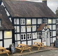
The Rose & Crown
Church Lane, Severn Stoke. WR8 9JQ
The Rose and Crown is nestled in the picturesque village of Severn Stoke in Worcestershire. A traditional 15th century pub serving delicious food, lovely well kept cask ales and fine wines. In between the towns of Kempsey and Upton on Severn we are the place to stop for a roast, quick pint or to sample our traditional English pub grub. We have plenty of parking and a wonderful garden to while away the hours in the sunshine with some friends.
-
The Severn Rivers Trust
Unit 3, Hope House Farm Barns, Hope House Lane, Martley. WR6 6QF
An independent environmental charity established to secure the preservation, protection, development and improvement of the rivers, streams, watercourses and water bodies in the Severn catchment.
More information
Many thanks to the folks at Severn Stoke for facilitating this camera's location and to Worcestershire County Council for capitally funding its installation. Please click here for flooding information regarding this location. In order to effectively monitor water levels and road conditions in the area prone to flooding, a strategically positioned Farson webcam is employed at the location where the A38 is affected. This webcam provides real-time surveillance, allowing for timely assessment and response to the changing conditions.During the medieval period, Severn Stoke resided within the boundaries of the Royal forest of Horewell. However, the majority of the woodlands were cleared around the time of the Civil War, altering the landscape significantly.A notable Grade II listed monument stands at the corner of Ham Lane and Church in Severn Stoke—the Severn Stoke War Memorial. This monument takes the form of a Classical obelisk crafted from Portland stone and was unveiled in 1920. It commemorates the sacrifice of 14 servicemen who lost their lives during the First World War, as well as 82 others who served abroad and 15 who served domestically.In a remarkable discovery, a hoard comprising 18 silver Saxon pennies was found near Severn Stoke in 1996, offering valuable insights into the historical context and economic activities of the region.